September 13, 2013

First Water Creek


The creeks are flowing right now in and around the Superstition Mountains due to lots of late-season monsoon rain. It's still pretty hot outside in early September in the Sonoran desert to do any long hikes. Keep in mind that it'll be in the 90's by noontime. The perfect compromise to this problem today was to do the Dutchman Trail #104 via the First Water Trailhead as an up and back hike. I have done segments of this trail as part of the 9 mile loop hike in Black Mesa Loop. By doing it as an up and back hike, you can keep an eye on the weather and return when things start heating up. The other benefit to following First Water Creek is that you can just wade through the creek to cool off. We went a little over a mile up the trail before turning around, but if you go further up, there are sections that almost necessitate some creek-walking -- fun, fun, fun!

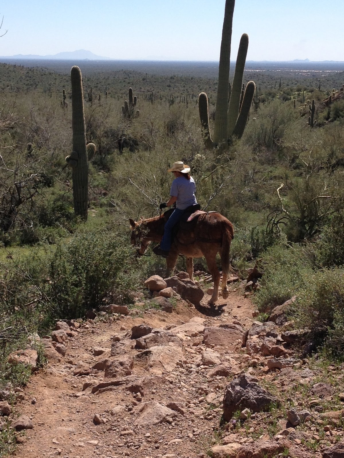
From the First Water Trailhead, follow the trail 0.3 mile until the first sign split where you will veer to the right on the Dutchman's Trail #104. From here, you stay on the Dutchman's Trail so this is the perfect hike for someone that doesn't like to do a lot of route finding. The temptation is there to veer to the left along the romantic-sounding Second Water Trail, but don't do it. If you want to follow First Water Creek, you will want to take the Dutchman's Trail. Not that the Second Water Trail isn't scenic -- see Hackberry Springs Loop -- but you will have to travel farther to see this much flowing water. Rarely do I see other hikers traveling this direction on the Dutchman's Trail. Today we didn't see another soul! We did run into a Friday the 13th, phantom-like horse-sound that frightened the bejesus out of us, only to discover that it was a large, extended family of Gambel's quail scurrying out of some jojoba bushes and up a cliffside. The vegetation was so thick and green from the recent rains that it was more reminiscent of a jungle than a desert at certain parts along the trail.


The other really cool thing about hiking right now is that September is traditionally apple-picking time, right? And this trail is no exception:


Yes, our desert-style apple harvest looks a bit more like the juicy, red Prickly Pear fruits. Those little harmless-looking white spots on the red fruit are actually quite sharp, and after picking this beast I had to remove some spiny barbs from my fingers. The fruit is a little sweet and full of seeds. I can see why the preferred eating method would be jam or wine. It kind of reminds me of a pomegranate but not sour.


Length: 2 to 7 miles as an up and back, depending on how far up the trail you go
Elevation gain: 300 feet
Time it took us: 1.5 hours as a 2.5 mile hike
Dogs okay: yes
Fees: No Tonto Pass required at this trailhead (at this time)
Directions: The First Water Trailhead can be accessed from metro Phoenix by US 60 east to Idaho Road and head north. At the intersection of Idaho Road and Highway 88, turn right and head northeast on Highway 88 towards Canyon Lake. After Lost Dutchman State Park, the First Water Trailhead, also known as Forest Road 78, will be on your right after milepost 201. The actual trailhead is about 2 miles down the dirt road, which is bumpy but passable without a 4-wheel drive.


March 6, 2013

Lost Goldmine-Cougar Loop

"Wasn't it snowing there a couple of weeks ago?"

Yup. Here's today ---->

Here's February 21st: (link)

Summer's scorching temperatures come on all too quickly in the Sonoran desert. After 16 years here, I have learned that it's freezing one day and too hot the next. We embrace this glorious spring while it's here. 

That's why I elected to play hooky from everything today and get outside in the lovely 79 degree weather before we get rain on Friday. Our schedules, probably like most of the country, are really complicated so you just have to seize the day from time to time and follow nature's call.

Having a touch of spring fever, I was determined to find wildflowers today. Unfortunately, with the cold temperatures and snow we had recently, wildflowers are making a later appearance this season. I knew the only way I was going to find these elusive Mexican gold poppies was to find a south-facing, lower elevation hillside. We've had enough rain so I knew they had to be out there somewhere, but I haven't seen any of our local county or state parks posting definitive sightings. 

Back to my trusty Superstition Mountains. Where I found snow on the northern flanks two weeks ago, today I found wildflowers on the southern flanks along the Lost Goldmine Trail. I have only done parts of the 9.5-mile Lost Goldmine Trail: the section leading to Broadway Cave, the section leading up to the hieroglyphs, and the far eastern section near Peralta Trail (which was pre-blogging.) One of the main reasons I haven't done the whole thing is it would require either (a) leaving a car at each end, or (b) doing an 19-mile round-trip hike -- neither option seems particularly fun to me. I like loop hikes. I don't want to see the same scenery twice. 

Often when I'm out on the trail, I think: "Who the heck took the time and energy to make this beautiful trail for all to enjoy?" I just can't imagine doing it. I think many people in life talk about taking on big projects and making positive changes in the world, but few actually follow through with plans. For the wonderful mountain bikers that made the Gold Canyon Trail System, you are all awesome! I hope you know how much enjoyment you have given hikers, bikers, and horse-riders with all of your labor. And these folks maintain the trails, too -- unbelievable! Lost Goldmine Trail was made by Superstition Area Land Trust volunteers in conjunction with Tonto National Forest, but the Cougar Trail that allows us to make a manageable 5-mile loop, sprung from volunteer mountain bikers. I highly recommend checking these trails out. If you are a hiker, I'll have you know that I didn't pass a single mountain biker on a midweek afternoon out there. No fears about getting run off the road, and they are polite anyway. 

When you start out at the Cloudview Trailhead (I know this as the Hieroglyphics Trailhead but it is actually on Cloudview Road so there you go), you will follow the trail up the hill with everyone. Once at the top, there will be clear signage pointing either left for the Hieroglyphics Trail or right for the Lost Goldmine Trail -- go this way. If you hike this trail in the next few weeks, you will see clusters of poppies and lupines about 1.5 miles down the trail. Here's a sampling: 


If you're too late in the season or weather destroys the flowers, there are still plenty of interesting landmarks along this trail: a Saguaro with a dislocated shoulder, a tree fort, and a sentinel grove: 


Just remember to pay attention at around mile 2.3 because there is not an actual sign that says "Cougar Trail" when you are approaching from this direction. The sign says "<--- Lost Gold --->" and you will bear right up the hill here like this:

The Cougar Trail is beautifully maintained and a fun series of up and down hills, washes, and "meadows" like this:

There is another slightly confusing trail split when you come to the Gila Monster Trail turn-off. Just remember that you are making a clockwise loop so you will always be bearing to the right. When you get to the sign that says "2GM" you will bear to the right like this and stay on the Cougar Trail:

And when all else fails, just follow the horse droppings! Just kidding -- it is easy route finding! Enjoy!

Length: 5 miles
Elevation gain: 300 feet
Dogs okay: Yes
Fees: None
Directions: From metro Phoenix, take US60 east to Gold Canyon and exit left (north) at Kings Ranch Road (a streetlight.) Follow Kings Ranch Road approximately 3.5 miles until you see the brown and white trailhead sign where you will bear left and continue following the trailhead signs. You should not hit any dead-end streets while you follow these signs until you hit Cloudview Road where you will turn right. The Cloudview Trailhead parking lot is at the end of the road.


February 21, 2013

Massacre Grounds

We had a rare snowfall in Apache Junction last night, so I decided before bed that I would wake up early and go hike today in my beloved Superstitions. Knowing that the snow would melt quickly this morning, I chose a north-facing slope to hike along, and the obvious choice was the Massacre Grounds trail. I hadn't been out along this trail since 2010 when the trail was basically following rock cairns alongside a popular target shooting area. The new trail begins at the Crosscut Trailhead parking area along the Firstwater Trailhead dirt road just past mile marker 201 and Lost Dutchman State Park along AZ 88 (the highway that goes to Canyon Lake.) The new trail adds a little bit of length to the hike so it is now nearly 6 miles long for the total up and back to Massacre Falls. However, we weren't interested in doing the entire trail length this morning because we were just snow searching! The snow-tipped mountains and cacti are just stunningly gorgeous together. It's so hard to believe that this area sees temps above 110 degrees Fahrenheit for the majority of the summer. I only passed one other hiker this morning, and he assured me that the waterfall is running so for those of you that want to do the full 3 miles up, it will be well worth it. I went a mile and a half up the trail today and ended near the first set of rock spires to get some beautiful views of the mountains. I stopped by a large, over 6-foot tall, granite boulder, and listened to the snow melt on the nearby bushes like the sound of running water. By the time I returned to the trailhead parking area around 10:30, most of the ground snow was gone, but it's still on the peaks and could make for a wonderful hike through the weekend.

Length: 5.8 miles
Elevation gain: 1000 feet
Dogs okay: Yes
Fees: None
Directions: From metro Phoenix take US 60 east to Idaho Rd. (AZ 88) exit and head north (left) following it past Lost Dutchman State Park and turn right at the Firstwater Trailhead turnoff past mile marker 201. The Crosscut parking area is 1/4 mile on the right and is easily passable without 4WD. The Massacre Grounds trail begins on the far left side of the parking area.

Just FYI, here's a link to a previous post I did about the Massacre Grounds if you're interested in the history:
http://ourhomeschoolmystery.blogspot.com/2010/11/massacre-grounds.html


Jojoba bloom
Lichens likin' snow
Four Peaks


March 17, 2012

Cat Peaks Loop

Today is St. Patrick's Day and everyone is thinking about green landscapes, even here in the Sonoran Desert. Although we don't have lush green meadows, I'm here to tell you that this desert is home to over 2,000 plant species, and they are ALIVE right now in the springtime! Here is a sampling from my hike earlier this week around the Cat Peaks of Usery Mountain Park:

Brittlebush
Hedgehog Cactus

Creosote
To get to the Meridian Trailhead where this hike begins, go due north along Meridian Road in Apache Junction until the road ends at a small dirt parking lot. Meridian Road can be accessed from metro Phoenix, either from US60 east to the Signal Butte exit going north off the freeway (left) and then east (right) on Lost Dutchman Blvd and north (left) on Meridian Road, or from the 202 Red Mountain Freeway to the Brown Road exit (which becomes Lost Dutchman Blvd) and head east (left) off the freeway and north (left) on Meridian Road.

The trail starts at the northwest end of the Meridian Trailhead parking lot. From here, the goal is to cross over from the Tonto National Forest land to the Usery Mountain Park boundary. This section is the hardest route finding of the hike, but there is a clear (but unmarked) trail going down into and out of the ravine that will put you on the Pass Mountain trail. You can see the twin Cat Peaks southwest of the Meridian Trailhead so you will know that you want to keep veering to the left after the ravine and not make the mistake of going right and ending up on a 7-mile trek around Pass Mountain -- no no! I took a picture of the trail as it looks just a short distance from the Meridian Trailhead as it descends down into the ravine to cross over:


Once across the ravine, go left on the clear trail that you intersect with, and you will be on the Pass Mountain trail. Here's a park map to help you out: http://www.maricopa.gov/parks/usery/pdf/2012maps/usery-11x17-3d.pdf  Along the Pass Mountain trail, there is a fence on your left. When you get to the Cat Peaks, you will finally see some signage. There will be a break in the fence on your left, and you will be staring straight up at one of the Cat Peaks. You have a choice to go clockwise or counter-clockwise around these peaks. Either way is scenic -- we went clockwise this time, and then included the Cat Peaks Pass section so we could take in the views from the top. Wandering around these peaks looking for spring flowers isn't too much work because there are less than two miles of total trail mileage around and over them. After the peaks, we returned east along the Meridian Trail, and we turned north on Meridian Road to head back to the parking lot. Someone else clocked the hike for me with a GPS, and even with all of our wandering, we still came in at 4.4 miles of easy and beautiful spring hiking.

Length: 4.4 miles
Elevation gain: 300 feet
Time it took us: 2.2 hours
Dogs okay: yes
Fees: suggested $2 per hiker upon exit of the Meridian Trail at the self-pay station

March 3, 2012

Sutherland Trail

"Hi ho, hi ho, it's off to work we go . . . "

I remember the exact moment along the Sutherland Trail when my daughter told me that was her hiking song. I laughed at that because we all have songs going through our heads to get us through something monotonous. I told her that we use, "Ah, ha, ha, ha, stayin' alive, stayin' alive," for CPR compressions in the ER, and she thought that was hilarious.

Rarely do I pick a one-way, out and back trail to hike because I don't like the boredom of seeing the same terrain twice. The exception to this guideline is if there is a clear destination I'm trying to get to: such as, the view of Weaver's Needle on the crest of the Peralta Trail, the rock art at the end of the Hieroglyphics Trail, or the cave atop the Broadway Cave Trail. In the case of the Sutherland Trail in Catalina State Park, the clear destination was spring wildflowers. And WILD they are, if you go RIGHT NOW! Literally, hillsides of Mexican Gold Poppies with Lupines splashed in there for color.

From the trailhead parking lot, follow the signs that direct you left along the Sutherland Trail. Yes, the majority of people will be taking the Canyon Loop Trail -- I don't know why; I'm sure it's lovely, but if you're looking for wildflowers, then the Sutherland Trail is the one you want. You will be following a streambed, and, at times, crossing it. The trail splits off at a staircase, but you want to follow the clearly marked signs pointing you left along the Sutherland Trail and up a rock staircase. Shortly up these stairs, you will begin to see the wildflowers. We lingered a long  time in this area taking pictures like crazy by lying on the ground, posing on boulders, and annoying bees with close-ups.

While going up the second rock staircase, turn around to get shots of the flowers with Saguaros and Barrel Cacti in front. At the top of these second stairs, you have a choice to keep going along the Sutherland Trail, and other hikers did tell me that there were some more patches of flowers further along (the Sutherland Trail goes 10.6 miles up the side of Mt. Lemmon.) However, we were so enamored with this area of flowers that we elected to turn around at the top of the second staircase where there is an unmarked trail going hard-left off the Sutherland Trail (it forms a "V.") From here, you can do a loop around this heavily-flowered area to come back down the hill and reconnect with the Sutherland Trail to head back the way you came. In a sense, you are doing a counter-clockwise loop around the flower field. Cutting this hike off here at this point creates about 2.4 miles total of easy hiking that almost any flower-loving hiker can do. Hopefully, the blooms will keep up since it is still early in the season, but there's no telling so I'd go soon.

Length: 2.4 miles
Elevation gain: 200 feet
Time it took us: 2.5 hours with lots of photography
Dogs okay: yes
Fees: $7
Directions: The actual address to the park is: 11570 N. Oracle Rd. in Oro Valley. If at all possible, I highly recommend taking the Pinal Pioneer Parkway (Highway 79) to get to the park. From the far East Valley of metro Phoenix, this took me just over an hour and a half along this route. Along Hwy 79 past Florence, the wildflowers are absolutely gorgeous with Globe Mallows, Brittlebush, and Penstemons mixed in with the Poppies and Lupines, particularly between mile markers 105 and 106 and again between 112 and 113.


Poppies

Lupines

Rock Staircase

Streambed


The Lost Dutchman (I guess)


Hikers


Plan B: This photo was taken along Picture Rocks Road in Saguaro National Park where the blooms are just starting.

February 17, 2012

Urban Lakes: Red Mountain & Tempe Town Lakes

Great Blue Heron catching dinner at Tempe Town Lake
I miss being around water. Although many of the hikes that I've been posting about follow streams, lakes, and rivers, I still feel very landlocked here in the Arizona desert. I now realize how very much I took for granted growing up near the Pacific Ocean. Every birthday party, graduation party . . . even senior ditch day, took place at the beach. Exercise was . . . walking on the beach. Cooling off was . . . going to the beach. A nice meal out was . . . down by the beach. So I thought I'd post today about two places here that I like to go to find some expanse of water. Neither of these walks are particularly "hikes," but both make a really nice stroll; especially if you aren't into the rugged thing, but you just want some easy exercise.


Red Mountain Park Lake
Red Mountain Park Lake is just west of the 202 Red Mountain freeway along Brown Road in Mesa. The large and paved perimeter pathway around the lake is about 0.85 miles and very pleasant. My normal routine is to walk around the lake three times, and I can usually do this in about an hour making a 2.5 mile total walk. Along the way, there are people riding bikes, rollerblading, and fishing along the shore. I have also spotted many varieties of birds, especially different waterfowl, and rodents. Parking is super easy on either side of the park, and leashed dogs are allowed.
Tempe Town Lake is a man-made lake created by the damming of this section of the Salt River with inflatable dams. The way I like to do this lake is to park at Tempe Center for the Arts and begin the walk about 1.5 to 2 hours before sunset. If you begin at Tempe Center for the Arts, you will see a modern pedestrian footbridge going across the lake, but don't go over it yet! Instead, go due east towards Tempe Beach Park, and the old Mill Avenue Railroad Bridge will be the first bridge that you go underneath:


After going underneath the four Mill Avenue bridges, and past Tempe Beach Park with the rowers setting out for their before-sunset rows, you will continue along the path to the Rural Road (also called Scottsdale Road) combined pedestrian/vehicle bridge and turn left (north) over the bridge. Once on the other side of the bridge, turn left again (west) to begin forming a loop around the lake. Along the path coming down from the bridge, you might spot some people/trolls living underneath the bridge near some pygmy palm trees. Usually they are just sleeping. If you continue along the path, now due west, you will come to the marina:


Across the lake from the marina, you have good views of ASU and "A" Mountain with the lake in front. There is also public art along the path, and signage about the history of the lake and water usage. From the marina, under the four Mill Avenue Complex bridges, and then to the Tempe Center for the Arts footbridge is my favorite section if you are hitting this stretch just as the sun is setting. The whole loop is about 3.15 miles and well worth the walk if you are looking for water in the desert!


February 3, 2012

Beverly Canyon Loop

I have renamed this hike the "Fry's Electronics Hike" because the only real reason I decided to try it is because I needed to trek out to Fry's, and the trailhead is only a few blocks away. I make no secret of my preference for the desolation and lush vegetation of the Superstitions, but South Mountain has certain conveniences. Really, the Fry's Electronics theme is carried on right up to the trailhead parking lot which is next to an industrial park. I made sure to grab a parking space adjacent to the security kiosk for the warehouse figuring that the security guard might notice if my car was getting broken into . . . which would further the Fry's Electronics theme to, "Here's the place where I lost my purchases."

I have found, though, that some of my best hikes have been those that I have had the lowest expectations, and this hike is no exception. We have been blessed with some beautiful weather this winter, here in the desert, creating a somewhat early spring. We started the hike on the west side of the trailhead parking lot with the Javelina Trail, and not more than 200 feet up the trail did I find my first wildflower:

Mexican Gold Poppy

The flowers are just starting to bloom along the northern flanks of South Mountain along this portion of the Javelina Trail. A little further up the trail, we also saw some lupines and brittlebush just starting to bloom. Javelina Canyon is really lovely with birds singing on top of the saguaros, and on a Friday afternoon, we passed just a few other hikers. Every so often we would turn around and look north towards the Phoenix skyline and catch an airplane taking off or the bustle along the highways. We sat to break along the trail and noticed our dogs getting excited about something. We figured it was just a rodent or a lizard, but then we looked on the hillside above where we were sitting, and we caught three coyotes trotting along on their way down the canyon. I quickly grabbed my camera to catch the last one in the group:


At the top pf Javelina Canyon, you will turn left (east) along the Ridgeline Trail. There are some really great views from up here. The further you go, the more Phoenix landmarks become apparent, and soon you will be making out Camelback Mountain, the Papago Buttes, Usery Mountain, Four Peaks, and the Superstitions. The views are great! However, it is pretty steep in sections with loose-packed rocks, great for sliding while being pulled by two dogs. Next time, I will bring my mountain goat instead. I also noticed a lot more hikers along the Ridgeline section, and it seemed like they hiked this trail everyday, and I was just an obstacle in their path. I definitely got an "urban hiking" feel from this hike, and I can't imagine what it would be like on a Saturday. Here's a sample of a part of the Ridgeline section:


After coming down the last hill of the Ridgeline Trail, you will turn left (north) onto Beverly Canyon Trail which feels like a paved superhighway after what you just finished. There is also a LOT of traffic along the Beverly Canyon Trail, both hikers and mountain bikers, but you can move pretty quickly along here by just following the overhead power lines back to the trailhead. It was a nice shaded end to the hike, if you complete the hike in the afternoon.

Length: 3.9 miles
Elevation gain: 500 feet
Time it took us: 2.5 hours
Fees: none
Directions: From Baseline Road, go south on 46th Street to the end of the road.