We started out by leaving one car at the Broadway Trailhead which has parking for about 6 vehicles total so get there early. We arrived around 9:30 on a Tuesday, and there were 2 other cars in the trailhead lot. I think you would have to go down Broadway a few hundred feet if the lot were full because there are "No Parking" signs directly below the lot. The area around the Broadway Trailhead is a subdivision of pricey, "semi-custom" homes. We watched them build these homes over the years, and it is amazing how much development there is now near this part of the Superstition Mountains. If you're coming from metro Phoenix, then you'll want to exit US 60 at Mountain View and head north. Turn east on Broadway and follow it to the end. The trailhead and parking lot will be on your left. Don't expect great signage; you're looking for a block wall fence and some gravel. Now, after leaving one car here, you're going to go back west on Broadway to Mountain View, and turn right so you will continue heading north. At Superstition Blvd turn left and head west. At Apache Trail/Hwy 88 turn right and head north again. To get to the McKellips Trailhead, turn right at Nodak where you will see a large sign for the Mining Camp Restaurant (if you end up at Lost Dutchman State Park, then you have gone too far on Hwy 88.) Take a quick left at McKellips and follow it to the end; this is a dirt road that was passable in our minivan up until the last part, which seemed too rocky so we parked along the road and didn't see any "No Parking" signs.
After leaving the car, it was a bit difficult to find the actual trailhead, but you'll want to go due north from the parking area, through an opening in the fence (set up for hikers we assume) and follow the little path through the wash and past some houses until you see a defined trail. This part was interesting and reminded me of hikes I took in Switzerland where the trail was literally flush with the homeowner's backyard. I want to live in a house where you have to hike in to get there! Anyway, this path will lead you to a large sign which is . . . blank! This is the meet-up point with the Siphon Draw Trail that originates at Lost Dutchman State Park. A few paces away from the blank sign, there is another point of small confusion, where the Jacob's Crosscut Trail crosses the Siphon Draw Trail. The brown sign points up to Siphon Draw, and left to Jacob's Crosscut. There is no labeling on the sign for a right turn. But we are clever folks, and figured out that this was a four-way intersection so we followed the trail right (mostly south and a little west at this point.) This was a gamble that paid off for us because it is, in fact, the southbound route of Jacob's Crosscut Trail.
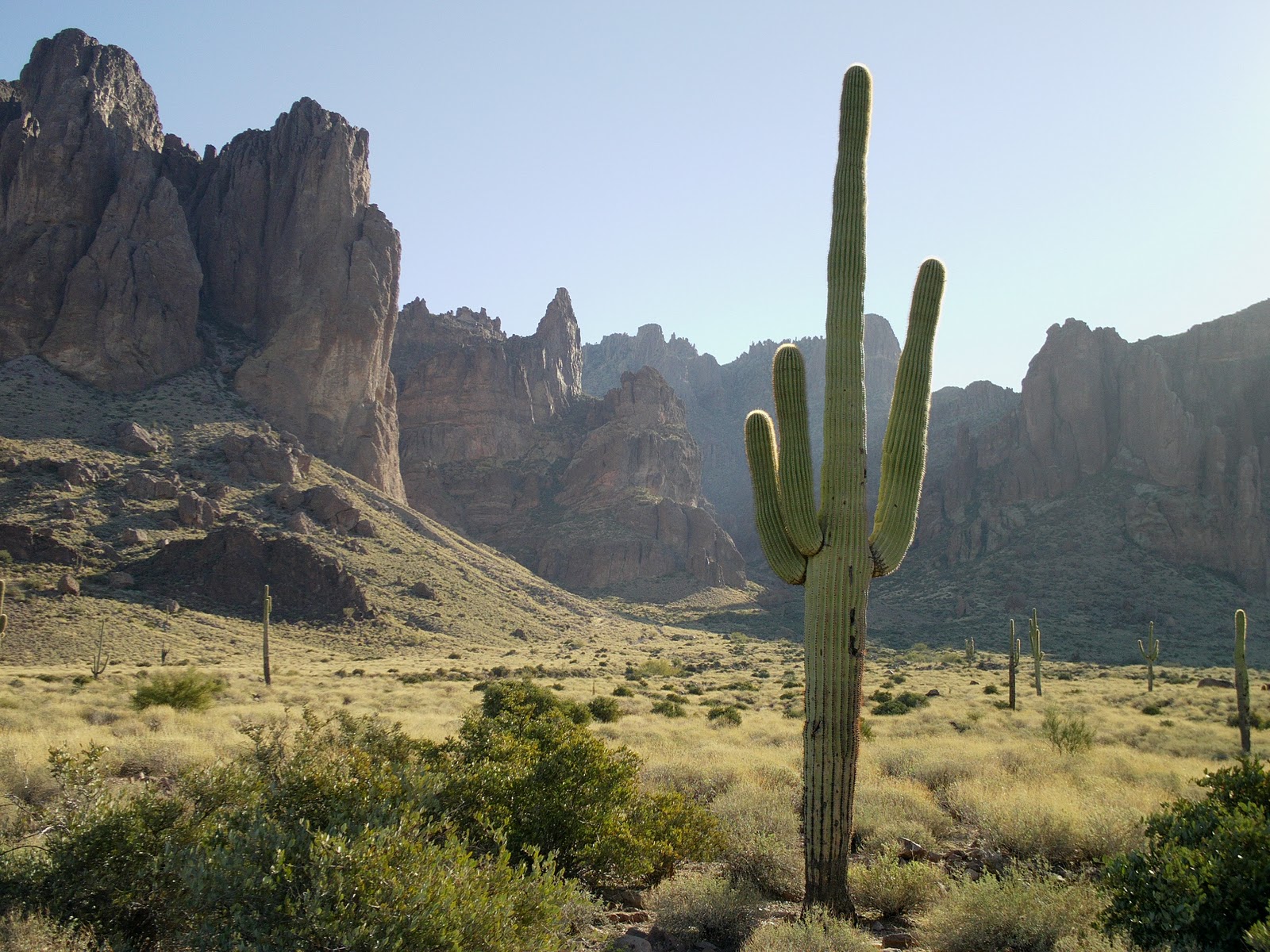
Once on Jacob's Crosscut Trail heading south, you will be looking west at views of Apache Junction and all the way out to Phoenix on a clear day. To the east are the Superstition Mountains which have a completely different look to them when you are this close up. I have seen this trail called the "Western Foothills" in some guidebooks, and the trail meanders over hill and dale, like foothills. This is a great trail for wildflowers in the spring, but I imagine it is also a great place for snakes because there is a lot of brush. We didn't see any wildlife this time of year (January.) About halfway through the trail, the scenery changes to ginormous boulders. Things get more rocky, and then you will drop down into a ravine and cross a very large wash. I had visions of all these giant boulders rolling down in an avalanche. Luckily, I think I missed that show by a few thousand years. Soon saguaros are popping up everywhere along the trail. When I first moved to Arizona, we took a trip to Saguaro National Park in Tucson, which I think is funny now because there seems to be a more dense forest of saguaro cacti here along the southwestern side of the Superstitions, than there are in the national park. You can also see these saguaros from US 60 when you are heading east. The trail is all loose rocks at this point, and can be difficult to navigate. You'll want to follow the trail with the "most" loose rocks on it. Frankly, this is my least-favorite part of the trail because it's hard to walk on, but you are less than one mile from the end, and there are some awesome views of Silly Mountain south from here. A side trip can also be made from here to Broadway Cave which is easily visible to the east on the side of the mountain. When you get to the "Y" intersection for the Lost Goldmine Trail you are just 0.5 mile from the end. You will start to see the backside of the pricey homes as you follow the Jacob's Crosscut Trail to the Broadway Trailhead where you left your car. Don't forget to go pick up car #2 while you drive past the entire mountain that you just traversed!
Length: 5 miles from McKellips Trailhead to Broadway Trailhead
Elevation gain: 200 feet
Time it took us: 3 hours with car shuttling
Dogs okay: Yes
Fees: No Tonto Pass required at these parking areas (at this time)


I am glad you enjoyed your hike. I enjoyed reading your account of the hike. Thank you for sharing your experience.
ReplyDelete